Cooper Marsh, Ontario, Sept 2013
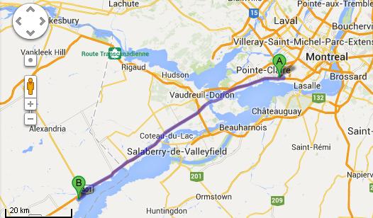
IntroFor today, which has been predicted (incorrectly) to be really hot and dry, Stephen decided that we should go to one of his favorite places whenever he visited Montreal, namely Cooper Marsh, in Ontario. It's about 80 kms from the hotel. It's a nature conservation area, with a bunch of trails and boardwalks. The trails are all flat, something that really appeals to me. More on that below. The first step was to get from the hotel onto Highway 20, which would head straight for our destination. But there's a bunch of construction happening around here. Our immediate target was Avenue Dorval. Everywhere we turned, there were signs saying Dorval Detour. We kept following them. And after a few kilometers of driving, found ourselves right back at the hotel! Thinking that we had perhaps misunderstood a sign, we followed them more carefully, and realized that if we followed them we would just be going around in circles. So Stephen decided to take a slightly different route, which he knew would eventually get us onto the desired highway, and he was successful. This map shows the basic geography, not including our initial loop-de-loop. Point A is our hotel, and Point B is Cooper Marsh.
|
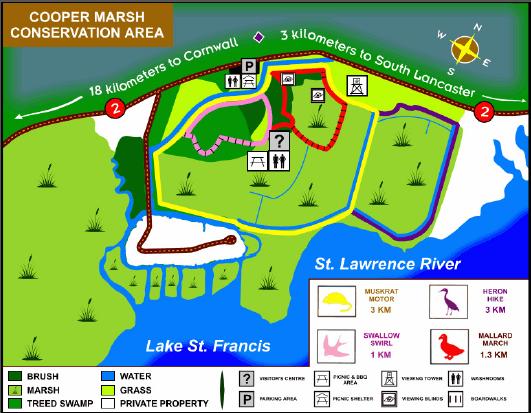
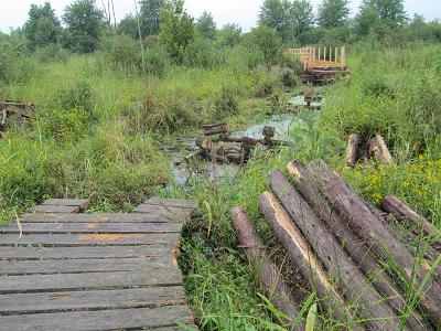
Cooper MarshSome people, especially those that are really into maps, check out a map ahead of time. In this case, Stephen just relied on his memories that there was a nice 5km loop that we could do. Unfortunately, it appears that they are rebuilding a boardwalk. So if we were on the loop, we were not going to be able to do the loop. So we backtracked, did a bunch along what might have been the other part of the loop, backtracked again, and ultimately did just over 5 kms in total. The challenge was that Stephen had only ever done the loop in one direction, so he wasn't quite sure how to approach it from another side. In any event, here is an official map, courtesy of (actually, stolen from) the Ontario Conservation Areas website.
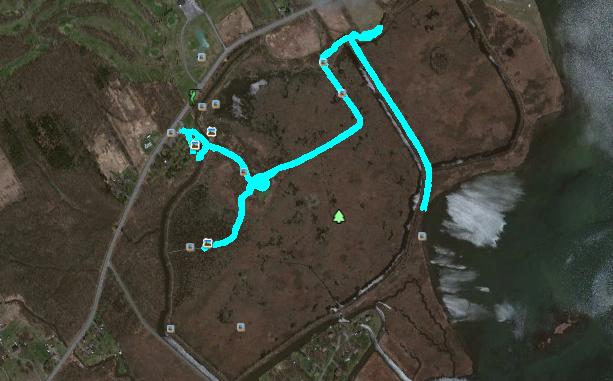
Here is the Google Earth shot of our hike - yep, we should have checked the map before setting out!
|
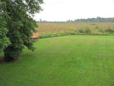
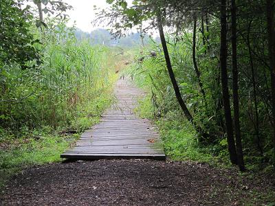
The trailHere are some pictures of the trail and the general scenery.
Here's where we found out that we couldn't do the loop that we had planned. Notice the poor quality of the boardwalk on which we were standing. It was actually quite difficult for me to walk on it, because the gaps between the boards were larger than the knobbies on the ends of my walking sticks. So I had to keep my head down to make sure that I was placing the walking sticks in a safe place. Not that it was particularly safe - thanks to the rain earlier, the boards were quite slick.
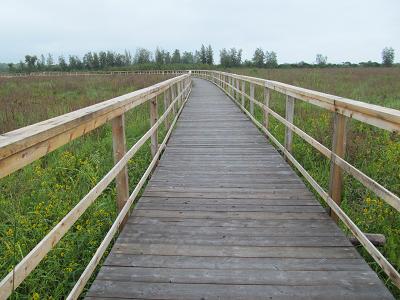
A much better boardwalk.
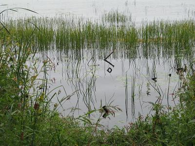
And some pretty reflections in the shore waters of the St. Lawrence.
|
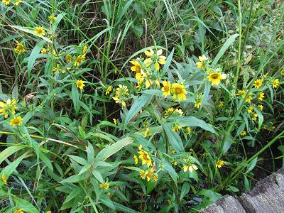
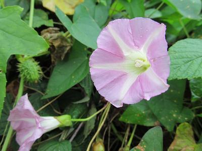
FloraOf course, I was quite taken by the flowers. Lots of colors. I don't know most of the names, of course!
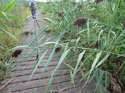
Even this grass looked interesting.
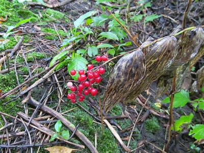
And these berries were so bright against their faded foliage.
|
|
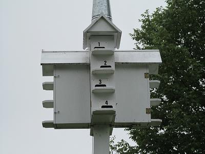
FaunaFirst is just some evidence of avian fauna, a bird apartment with suite numbers.
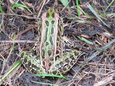
We kept seeing things hopping off the trail, but just out of the corners of our eyes. Finally, we realized that one had stopped still long enough for me to get the photo.
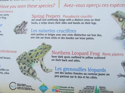
Fortunately, there was an interpretive sign nearby all about frogs, so we figured out that it was probably a Northern Leopard Frog.
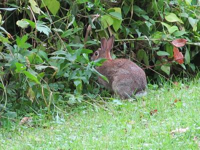
We also saw this rabbit, much browner and smaller than those that cavort in our back yard.
|
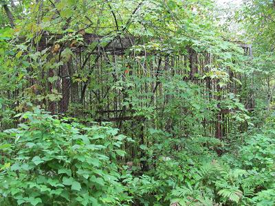
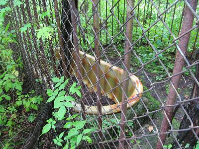
Something UnusualWe were hunting (unsuccessfully) for a geocache, and found this cage structure:
Inside the cage structure, was a bathtub surrounded by concrete - all very old.
There must be a story there! But I have no idea what that story is. |
|
After the hike, we went for a late lunch, and then drove on scenic Lakeshore Drive, taking the slow route back to our hotel.
Stephen has just printed the boarding passes for our flight to Zurich tomorrow afternoon. In the morning, we are going to Hudson to visit one of his old family friends. The next report will be from Switzerland in a couple of days. |